
- Видео 210
- Просмотров 525 906
3Dsurvey
Словения
Добавлен 30 сен 2011
Photogrammetry software solution for land surveying professionals. 3D mapping & modelling. Fly a drone, generate point clouds, 3D meshes, orthophotos, survey maps and more.
Creating an Orthophoto from point cloud in 3Dsurvey
Create an orthophoto directly from a point cloud. Follow our step-by-step guide to calculate orthophotos by setting your desired resolution and inputting a point cloud. Additionally, discover how to generate custom plane orthophotos, perfect for facades and other specific structures. Sharpen your surveying skills and produce accurate orthoimages with ease using 3Dsurvey.
Просмотров: 110
Видео


Aligning Terrestrial Laser Scans in 3Dsurvey: Manual and automatic guide to Point Cloud Registration
Просмотров 2067 часов назад
In this 3Dsurvey tutorial, learn how to align multiple point clouds using both manual and automatic registration. Load your non-aligned point clouds and learn how to define identical points, and fine-tune the alignment to achieve accurate 3D models. Perfect for users working with terrestrial laser scans, but not limited to just point cloud data Check out special promotion, get the new modules 5...
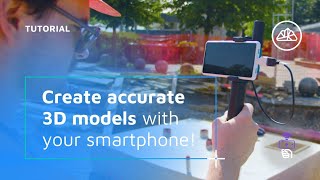
Handheld RTK Videogrammetry with 3Dsurvey: Step-by-Step Guide for Accurate 3D Models
Просмотров 4277 часов назад
In this tutorial, we explore the capabilities of RTK videogrammetry in 3Dsurvey. Transform a site video footage into accurate 3D models. Learn how to capture video with a handheld RTK device and mobile phone, ideal for scenarios where drone flights are not feasible. Follow our step-by-step guide to set up your devices, capture the footage, and process it into detailed 3D models, perfect for doc...

Setting Up Coordinate Systems in 3D Survey 3.0: A Step-by-Step Guide
Просмотров 16212 часов назад
This tutorial explains the new user interface of 3Dsurvey. 3Dsurvey 3.0 upgraded coordinate system selection process with presets allows users to select the correct coordinate system much more easily - just type your country name and the right coordinate system will be preset for you! 3Dsurvey: SAVE TIME AND GAIN CONTROL. 💪 Hit the SUBSCRIBE button to stay updated ☑️ Start the FREE TRIAL now: b...

Webinar: What’s new in 3Dsurvey 3.0
Просмотров 50014 часов назад
3Dsurvey 3.0 is out on June 27. 2024! 🚀 The biggest release in 3Dsurvey history! Impactful version 3.0 offers a wide range of new possibilities and improvements - including a number of subscription based add-on modules - in line with the company’s mission to offer powerful spatial data processing tool in a simple to use and all in one platform. Check out special promotion, get the new modules 5...

3Dsurvey Partner Meeting - LJUBLJANA 2024
Просмотров 110Месяц назад
3Dsurvey's first international partner meeting held at Mons Hotel in Ljubljana, April 2024. This event marked our 10 year anniversary of 3Dsurvey software! Day 2 was spent exploring the city, ending with lunch at the castle. 3Dsurvey: SAVE TIME AND GAIN CONTROL. 💪 Hit the SUBSCRIBE button to stay updated ☑️ Start the FREE TRIAL now: bit.ly/3D-free-trial Follow us on social media: - Facebook: fa...

3Dsurvey User Group Meeting - SMLEDNIK 2024
Просмотров 141Месяц назад
Check out the highlights from 3Dsurvey's 2024 User Group Meeting in Smlednik, where we talked about new trends in geodetic data collection, advanced tools for editing and combining point clouds, RTK Videogrammetry and more! Join us next year! 3Dsurvey: SAVE TIME AND GAIN CONTROL. 💪 Hit the SUBSCRIBE button to stay updated ☑️ Start the FREE TRIAL now: bit.ly/3D-free-trial Follow us on social med...

Advanced Volume Calculation in 3Dsurvey
Просмотров 409Месяц назад
Discover all the possible ways to calculate volume in 3Dsurvey. First step is always calculating regular grid mesh. 3Dsurvey: SAVE TIME AND GAIN CONTROL. 💪 Hit the SUBSCRIBE button to stay updated ☑️ Start the FREE TRIAL now: bit.ly/3D-free-trial Follow us on social media: - Facebook: 3DsurveySoftware - Instagram: 3dsurvey - LinkedIn: si.linkedin.com/company/3dsurvey...

Webinar: Using Photogrammetry for Solar Panel Installation Planning
Просмотров 428Месяц назад
Learn how to make 3Dmodels of the roofs you want to turn into solar power plants. What is the best equipment for the job? Learn best practices, how to produce orthophotos, vectorize roof edges and obstacles, and much more. Chapters: 00:00 - 05:02 - Intro and Quick Poll 05:03 - 06:26 - Agenda 06:27 - 10:27 - Benefits of using Photogrammetry in Solar Industry 10:28 - 16:26 - Recommended Hardware ...
3Dsurvey Cloud Webinar - Elevate your impact! Share your success, without boundaries!
Просмотров 5123 месяца назад
3Dsurvey Cloud Platform offers a seamless way of managing your projects in the cloud and sharing them with your partners and clients. Matija and Marko take a deep dive into the functionalities and possibilities of 3Dsurvey Cloud. Discover who gets it for free, what you can upload, what you can draw in it, and how to share your work with anyone. Chapters: 00:00 - 00:56 - Intro 00:57 - 02:22 - Pr...
Videogrammetry and other features in 3Dsurvey - Live presentation at Intergeo 2023
Просмотров 5285 месяцев назад
Our Product Manager, Marko, presented Videogrammetry and other exciting features in 3Dsurvey live at Intergeo 2023 on stage 2. The 3Dsurvey RTK Videogrammetry feature is extremely useful in many areas of Land Surveying, Construction, and similar industries (even Telecommunications, Utilities, etc.). By using the 3Dsurvey RTK Videogrammetry feature, you only need a phone, mobile RTK device and a...
3Dsurvey cloud workflow
Просмотров 5305 месяцев назад
Standard Cloud workflow. From finishing a project in 3Dsurvey to uploading it to the Cloud, select which data files you'd like to include and create new project on the Cloud survey selector page. Inspect the project and share with client. Visit the cloud here: cloud.3dsurvey.si/ ☁️ Hit the SUBSCRIBE button to stay updated ☑️ Start the FREE TRIAL now: bit.ly/3D-free-trial Follow us on social med...
3Dsurvey cloud guide - 3. Sharing your project
Просмотров 5655 месяцев назад
3Dsurvey Cloud Viewer simplifies project sharing and offers viewers the ability to interact with the models and perform some basic functions. In this video we show you the possibilities of Cloud Viewer and how to navigate the tools easily. Visit the cloud here: cloud.3dsurvey.si/ ☁️ Hit the SUBSCRIBE button to stay updated ☑️ Start the FREE TRIAL now: bit.ly/3D-free-trial Follow us on social me...
3Dsurvey cloud guide - 2. Navigation
Просмотров 4085 месяцев назад
Learn how to navigate through 3Dsurvey cloud. Manage your projects, view the timeline and a map. Switch from 2D to 3D view, compare side-by-side, inspect point clouds, meshes and orthophotos. Upload CAD data, draw lines and measure distances, slopes and more. Visit the cloud here: cloud.3dsurvey.si/ ☁️ Hit the SUBSCRIBE button to stay updated ☑️ Start the FREE TRIAL now: bit.ly/3D-free-trial Fo...
3Dsurvey cloud guide - 1. Login troubleshooting
Просмотров 3575 месяцев назад
We still get a some incoming questions about how to access Cloud, where to log in, etc. Here is a short instructional video that answers these questions! Access Cloud directly from 3Dsurvey software or log in via web. If you are struggling to find the correct email address attached to your license, please email support! support@3Dsurvey.si Cloud is only available in version 2.18! Extend your su...
Basic Volume calculation in 3Dsurvey: A step-by-step guide
Просмотров 1,2 тыс.6 месяцев назад
Basic Volume calculation in 3Dsurvey: A step-by-step guide
Select by Color (What's new in 3Dsurvey 2.18)
Просмотров 6907 месяцев назад
Select by Color (What's new in 3Dsurvey 2.18)
CAD Tutorial (What's new in 3Dsurvey 2.18)
Просмотров 1 тыс.7 месяцев назад
CAD Tutorial (What's new in 3Dsurvey 2.18)
Webinar: What’s new in 3Dsurvey 2.18
Просмотров 1,2 тыс.7 месяцев назад
Webinar: What’s new in 3Dsurvey 2.18
Webinar: What's new in 3Dsurvey 2.17
Просмотров 1,1 тыс.11 месяцев назад
Webinar: What's new in 3Dsurvey 2.17
Enhanced Transformation Tool: Align two objects based on identical points in 3Dsurvey 2.17
Просмотров 1,3 тыс.Год назад
Enhanced Transformation Tool: Align two objects based on identical points in 3Dsurvey 2.17
3Dsurvey Photogrammetry meeting - Smlednik 2023
Просмотров 1 тыс.Год назад
3Dsurvey Photogrammetry meeting - Smlednik 2023
3Dsurvey RTK Videogrammetry as a powerful tool for documenting and tracking construction progress
Просмотров 4,4 тыс.Год назад
3Dsurvey RTK Videogrammetry as a powerful tool for documenting and tracking construction progress
Speed up your workflow with these tips & tricks
Просмотров 1,1 тыс.Год назад
Speed up your workflow with these tips & tricks
Import orthophoto and DXF into SolarEdge designer - 3Dsurvey
Просмотров 1,8 тыс.Год назад
Import orthophoto and DXF into SolarEdge designer - 3Dsurvey
3D CAD drawing on images: Effortless and accurate vectorisation
Просмотров 1,7 тыс.Год назад
3D CAD drawing on images: Effortless and accurate vectorisation
Добрый день! Скажите как можно уменьшить размер цели RGB (XYZ) ? При увеличении она очень большая и мешает моделированию...
What is the hardware for the rtk you were using?
REDCatch RTK antenna combined with pixel 7a phone was used in this case.
Good evening from California. I’ve been trying to add the module for “Scan” when I’m in the Program it says to go to web store. Is the web store different than “web site” Because when I log in there it sends me to my account page, no options to add module there. Was thinking maybe not avail yet? Anyway looks like will be useful. Thanks
Hi Steve, when in your account page, you have to select a specific license, by clicking "Details" (or go to "Licenses" in the ribbon and select it there), then you will have an option ("Purchase" button) to buy the modules.
Yes that was it. Thanks
After the point cloud 3d model is generated, what is the error in the length measurement?
Whitepaper was produced for this case, where absolute and relative errors were documented. Find it on our webpage: 3dsurvey.si/wp-content/uploads/2024/06/Videogrammetry_Accuracy_for_Point_Calculation__using_Mobile_Phone___RTK_Antenna_-1-1.pdf
Good job, bravo! Will the scan app work with a gps and gnss device or must an rtk device be paired?
If you are able to pair your android device with it to get the location, SiteScan app will be able to write the location onto video.
Very good option on new coordinate feature Did I miss how the data set was acquired for the X-ray ?
It was obtained with handheld slam scanner.
How to calculate the volume of a upright tree. If I have a cloud of points of a tree and when I cut a section log of the tree with a height of 2m or else, how can I get the volume of such an irregular body?
ruclips.net/user/shortsjveRT7jkeBs?si=AMvLoihsAKXslgoW
It's not super straight-forward, but it can be done for simple upright trees. You need to create a lower level DSM (technically it's DEM, because tree is not surface) and upper level DEM, then you can calculate a volume between the two elevation models.
Thank you.
What if 1 or 2 sides of the stockpiles are near the wall (for example: container) and the bottom of the stockpiles 1-2 edges are not visible?
There is a trick you colud do: 1. Go to your point cloud, duplicate it 2. Select your volume, as accurate as you can 3. Delete it 4. Calculate DSM again 5. Now you have two surfaces, to compare the volume between.
Thank you for using one of our projects as a showcase in the webinar. The finished project looks even better than the model, and that already looks pretty cool. 😎
Thank you so much for providing it. It really is a textbook case. We wish you a lot more stunning 3D models in the future.
Very informative thanks to both of you. I use the 3ds software daily. Keep up incredible work. Is there a way to download the Solar Edge Design software to try without a having a commercial license?
Thank you Steve! SolarEdge Designer is free online software, you just have to register. Keep up the good work.
Excellent! Thank you for your work
Could filming in 360 with an insta360x4 work?
Right now, not. But there will definitely be a video on it, when it does.
@@3Dsurvey ok, thanks for your feedback
is there any offline trainings avalaible
Sure, our local partners offer 1on1 trainings as do we.
Excellent!! Thank you
What about 3D area?
To see 3D area use measurement tool.
Is it possible to see the 3D area label/measurements on the model?
You can see the 3D area of a measurement in the proprerties. However, right now, there is no option to display 3D area of a measurement on a model.
Keep up great work. This is definitely a program for serious drone work. Much appreciated.
can you export the georeferenced image to cad file ?
Of course. 3Dsurvey orthophotos are georeferenced. The easiest way to import would be MAPIINSERT.
Where is that software for video capture with location?
Hello Boško, Please send us an email on support@3dsurvey.si to get instructions directly.
please can i install in smart controll rc2 ?
What mobile app do you use to record video with Bluetooth connection and where can it be downloaded?
Hi! We use the 3Dsurvey ScanApp. It has not been officially released yet. We were giving it to 3Dsurvey users on request. It will be published with our soon-to-be released 3.0 version update.
هل يستخدم للبحث عن الذهب في باطن لارض
Can I videogrammetry using drone? I want to inspection facade and making 3D model of more than 20 floors appartment. 3Dsurvey can every videos to pointcloud?
Hi, technically you can. However drones do not write coordinate info in video, so you will not get good locations. For best results stick to photos.
Mala aplicacion
Air 2s ile uyumlumu Mission upload failed: The execution could not be executed. Uyarısı alıyorum sorun nedir?
Добрый день! Для этого нужно иметь активную подписку на обновления?
Hi Pavel. Yes. Active subscription or perpetual license with updates and support.
@@3Dsurvey Спасибо за ответ🙏
Thank you for the detailed video. I do have some questions though: 1) Is Solar edge designer the best for commercial solar design? 2) is the scale process the same with any kind of ortho photo including that of an automated 3D drone scan? 3) Has anyone been using the Mavic 3E for orthophoto captures for Solar edge designer? 4) Is DXF file the best way to import ortho drone model in to SED? Thank you
Hi Luke, This tutorial was created in response to a widespread user request. 1) We can't say if Solaredge designer is the best for the job, we only know 3Dsurvey is. 2) We didn't check all of them, but based on our expirience the procedure is always the same in Solaredge designer. 3) Mavic 3E is probably most popular drone for professional use on smaller scale projects, so... we are pretty sure plenty of people have done that. 4) Yes. There are other options, but we believe this is generally the best one.
I miss in 3dsurvey pilot the option to give more than 2 passes, it can be 4 because the oblique photos
Nice
This is the best software I am using for digitizing, This software very most important to lease convert to poly two point loud and point cloud convert into mesh, All options were important and logically develop, Congratulation, Deliver, most best serving software.
Need text and annotation ❤️
Hello 3Dsurvey team! thank you very much, it was interesting. we need to make a beautiful and geometrically correct photogrammetric model. Is it possible in your software to fix the mesh (uneven corners of the model, holes, thin roofs with holes) based on the tools for drawing structural lines from aligned photos?
hi, mesh manipulation in 3Dsurvey is only possible on a Regular grid mesh (digital surface model). Full 3D mesh does not have such options.
hello i have air 2s Mission upload failed when starting flight. It gives a warning that the execution could not be executed, I am new, what is the solution to this problem?
It has a very good accuracy.
Nokta bulutu oluştururken %85 lere gelen dosya kapandı nasıl geri açabilirim?
"Even though your image is georeferenced, you have to reference it here manually." Makes no sense, you have a perfect 3D model, then you have to spoil it. But this is not the worst thing, if you want to change the background image with a mere precise orthophoto, you have to use this scale and reference of the image, instead to overlay directly with all coordinates and dimensions.
We know, but that is how SolarEdge designer is. Or was, we saw it updated since then.
How could I find the location of a quarries for a given site?
Good tutorial! Is there a way to change the starting point when planning a TA flight? From my understanding, the drone will read the elevation from the DSM at the planned starting point (which usually I can do) , but could be up to 1000ft AGL by the time it reaches the starting point if I start on a mountain side. In the US we can only fly 400ft AGL. Any tips or tricks on how to keep the same mission plan but move the starting point would be greatly appreciated.
The x and y coordinates of the starting point can be anywhere, meaning at the location of your take off. Since you defined the terrain elevation and the desired AGL, the drone will simply lift up to that altitude and start the mission.
You could also manually fly the drone to the start point if it's over 400ft AGL from your takeoff point, visually following the terrain to technically keep it under 400ft. You can then start the mission while the drone is already in flight. I always start my missions by manually flying to the start height to confirm camera settings at that height anyways. I had this issue with a cinema flight from a monument on the top of a mountain. I was 20ft AGL at the monument, but when I flew 100ft away from the monument over the cliff, I was 1000' AGL. In Canada we are allowed 200ft horizontally from a building or structure, but the rules don't actually cover steep terrain or mountains with a sharp cliff or drop off, since a mountain is not a structure. 901.25 (1) Subject to subsection (2), no pilot shall operate a remotely piloted aircraft at an altitude greater than (a) 400 feet (122 m) AGL; or (b) 100 feet (30 m) above any building or structure, if the aircraft is being operated at a distance of less than 200 feet (61 m), measured horizontally, from the building or structure.
Добрый день! Планируете ли вы сделать классификацию точек по цвету (например для меня сейчас сложная ситуация - карьер на котором местами выросла высокая трава и кусты). При классификации по углу рельефа не могу настроить так чтобы убирал растительность но оставил крутые элементы карьера.
Someone will be very happy with the 2.18 version...
@@3Dsurvey Спасибо 🙏
why would you calculate a texture with CPU ? Are you utilizing the GPU at all ?
ευχαριστούμε !
La empresa en la que trabajo compró 3DSURVEY pero nadie me enseñó a usarlo y estoy aprendiendo con estos videos. En mi procesado tengo diferencias muy grandes entre los datos obtenidos con Dji M300 RTK y los equipos topograficos de tierra de Trimble. Errores en torno a 30cm. Como es esto posible?? Supongo que algo estoy haciendo mal, pero no sé que es
Hi Julian, we're glad to have a new user. It's hard to know for sure what the problem is. It could be the wrong vertical coordinate system / geoid. But anyhow: whenever you are stuck and don't know why you get some error or mismatch, just write us an email to support@3dsurvey.si and we will take a look together.
Se pueden preprogramar las tareas para que se quede procesando un trabajo sin supervisión???? Igual que Pix4D
Project > Batch processing: Bundle adjustment > Orientation > Reconstruction > Mesh > Orthophoto
Good afternoon Could you help me with a problem: project 1700 photos, area 140 hectares. Version 2.17. - "Calculating full 3d mesh: Unable to allocate enough memory". What could be the reason? Software or hard drive? Core i7x12700KF, 64 ram, 250 gb freespace hdd (1 Tb all) workspace, hdd for windows 100 gb - 40 gb is free; rtx 3080...
Hi Pavel, Try decreasing the max triangle number to 2 million triangles
@@vidpeterman3303 Добрый день! Помогло только перемещение старых проектов на другой hdd и увеличение свободного пространства более 300 gb. Спасибо за ответ!
Very nice. Is there any way I can crop the edges of the orthophoto through a Polygon before exporting?
Yes. There are a few ways to do this: Cut in the Orthophoto tab, but it's just rectangular. Or you can apply selection of mesh from CAD, Delete other, and then create cropped Orthophoto.
How to used the Drone in Division of agriculture land please 🙏. I want to vidio language That
Can you use Dron in Division of agriculture land ?
Sure you can. But right now 3Dsurvey only supports visible light photogrammetry.
@@3Dsurvey Thanks 😊 🙏 my sir
Gran aporte, muchas gracias
Dear friend, please contact me, I need a sample log file, I want to know what is the difference in the records in the CAM, TRIG and other lines, My mission planer application cannot read the log file from the matek 405 se flight controller. Could you send a sample log file?
Have you used Drone extract coordinates and Have worked on Civil ? 😊
Coordinates are straight from a RTK drone. CAD layers can be exported to Civil via .dxf.